
Apk Link: https://cdn.organicmaps.app/apk/OrganicMaps-24081605-GooglePlay.apk
Note: If you don’t want to deal with stuff like this, I recommend you download and use it from F-Droid client or Accrescent AppStore.
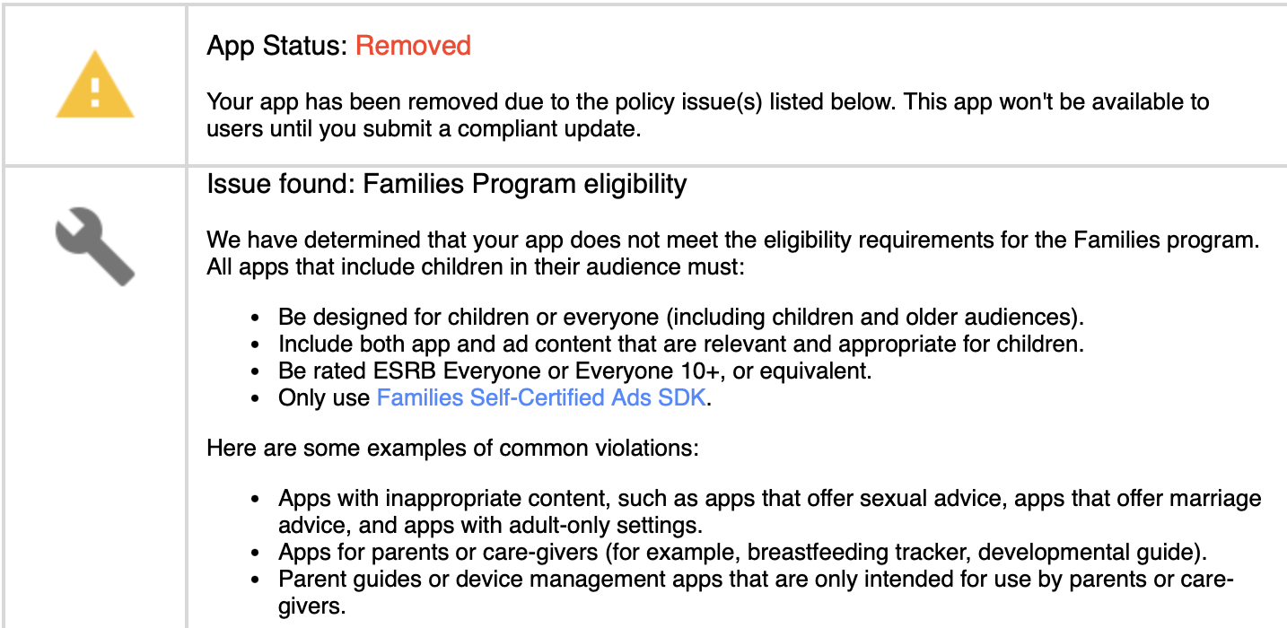
Update: The app returned to the App Store.
Long shot, but does anyone know of any mapping app where you can easily project a bearing/azimuth line, or a point a given bearing and distance from another point?
The only app I’ve found so far that can come close to what I need is Backcountry Navigator, which has a terrible UI. Everything else seems to be focused entirely on GPS navigation from where you are now to a known destination; I have yet to find one that allows even basic triangulation, to be able to identify the location of an observed object.
ATAK-Civ originally developed by the U.S. Military for tactical use on Android phones. It was open-sourced and released on the Play Store several years ago.
Wow.
That’s… Awesome.
Edit: That has pretty much every major feature I’ve been looking for.
Trail Sense might do what you want, and has a decent UI.